

How to Perform a Solar Site Survey: Assessment Checklist & Tools

Updated: Sep 10

Table of Contents
A solar site survey turns preliminary assumptions into verified design inputs. Skip it or rush it, and the design team ends up guessing at roof pitch, shading, or electrical service capacity. Get it right, and permitting, procurement, and installation all move faster.
Some installers call this step a solar site assessment. Others call it a solar panel survey. Either way, it is the same process: a structured look at a property's roof, electrical service, and shading conditions before a system gets designed. The data collected here becomes the foundation for the permit set, the interconnection application, and the customer proposal, and it plays directly into a property's solar rooftop potential.
This guide covers a step-by-step solar site assessment and pre-engineering process, a complete solar site survey checklist, the report format designers expect, and the tools and software field techs use. It also covers when a remote assessment is enough and when a technician needs to be on the roof.
Need help turning field data into a permit-ready design? Sign Up for Free to get started with GreenLancer's solar design and engineering services.
What Is A Solar Site Survey?
A solar site survey is a structured inspection of a property before a photovoltaic system gets designed. A technician records roof dimensions, checks the electrical service panel, and documents shading from trees or nearby structures. The goal is simple. Give the design team what they need to size a system correctly the first time.
Solar site survey and solar site assessment describe the same activity for most installers. NABCEP's PV certification study guide frames it as assessing orientation, shading, and installation suitability, which lines up with how most contractors use the terms day to day. Solar panel survey is another common name for the same process, especially in conversations with homeowners.
A solar site survey is not the same as a legal boundary or topographic land survey. Ground-mount and utility-scale projects often need a licensed land surveyor or civil engineer in addition to the PV site assessment covered here. For most rooftop residential and light commercial jobs, the process below covers what is needed to move into design.
Good site data shortens almost every step that follows. It reduces change orders, speeds up permit review, and gives the interconnection application accurate numbers from day one. Weak or incomplete data does the opposite. It forces redesigns, delays permitting, and can turn a signed contract into a stalled project.
Step-By-Step Solar Site Assessment And Pre-Engineering Process
Solar contractors typically perform site assessment and pre-engineering by reviewing aerial imagery and utility information first, then documenting roof and electrical conditions in the field. From there, they complete shading and structural evaluations and hand off standardized measurements and photos to the design team. Below is a repeatable version of that workflow for residential and light commercial projects.
Desktop prequalification. Review aerial imagery, utility bills, and a rough system size before scheduling a visit. This step filters out sites with poor solar access or obvious red flags early.
Customer and utility data collection. Gather electric bills, rate plan details, and any plans for EV chargers, heat pumps, or storage. This shapes system sizing before anyone measures a roof.
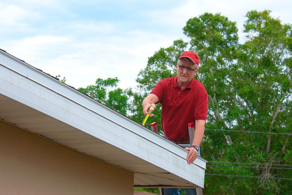
Roof and structural data collection. Document roof type, pitch, dimensions, and visible condition. Note framing details when accessible, since this feeds the structural review.
Main service panel and electrical review. Record busbar rating, main breaker size, and available capacity. This drives the interconnection method and whether a panel upgrade is needed.
Shading and solar resource analysis. Measure or model shading from trees, chimneys, and neighboring structures across the year. The Building America Solution Center's guidance on solar orientation is a useful reference for this step.
Battery or load addition assessment. Note wall space, clearances, and available electrical capacity when storage is part of the scope. Skip this step for PV-only projects.
Documentation and design handoff. Organize photos, measurements, and notes into a standardized report. A clean handoff means fewer callbacks to the field.
Every step builds on the one before it. A rushed desktop review leads to a wasted site visit, and a disorganized handoff leads to a design that does not match the roof. Treat this as one connected workflow rather than a set of separate tasks.
Solar Site Survey Checklist
A thorough solar site survey checklist keeps field techs from missing details that show up later as change orders. Use this as a starting point and adjust it for local code requirements and project type.
Property and access
Site address and access notes
Photos of the front, rear, and sides of the property
Any HOA or historic district restrictions
Roof measurements and condition
Roof type, pitch, and usable dimensions
Age and visible condition of the roof covering
Signs of damage, sagging, or prior repairs
Electrical service
Busbar and main breaker ratings, which feed directly into the 120% rule calculation for load-side interconnections
Available breaker positions
Meter and service configuration
Shading and array layout
Roof-plane azimuth and pitch
Obstructions like chimneys, vents, and HVAC units
Shading measurements across the year
Battery and energy storage
Proposed indoor or outdoor location
Wall clearances and access routes
Local fire code constraints under NFPA 855, covered in more detail in our solar battery storage permit guide
Permitting and installation notes
Local zoning and permitting requirements, which the Department of Energy outlines in its rooftop solar permitting and inspection overview
Conduit path from roof to service panel
Any project show-stoppers, such as an outdated panel or a failing roof
Solar Site Survey Report Format
The site survey report turns field notes into something a designer can actually use. A consistent format matters more than length, since engineers and designers need to find specific data points fast.
A complete report typically covers project and customer information, roof and structural documentation, electrical service details, and shading data. Each section should separate verified measurements from customer-provided assumptions. That distinction matters when a design gets challenged during plan review.
Report Component | Information to Capture | Why the Designer Needs It |
Main service panel | Breaker rating, bus rating, model, labels | Interconnection and load-side calculations |
Roof framing | Member dimensions, spacing, spans | Structural assessment |
Roof planes | Azimuth, pitch, dimensions | Module layout and production modeling |
Obstructions | Vents, chimneys, setbacks | Code-compliant layout |
Battery location | Clearances, access, barriers | ESS permitting and equipment placement |
Minimum photos for a residential solar site survey:
Front and rear property views
Every roof plane under consideration
Roof obstructions and close-ups of the roof covering
Main service panel exterior and interior, including breaker and bus rating labels
Utility meter
Proposed inverter, disconnect, and battery locations
Access routes and any potential trenching areas
Solar Site Survey Tools And Software
Solar site survey tools fall into two buckets that get confused often. Some are handheld equipment a technician carries to the roof. Others are software platforms that measure, model, or estimate a site remotely. Both matter, and most installers rely on a mix of the two.
Essential Field Survey Tools
A well-equipped technician needs more than a ladder. Here is a baseline kit for most residential and light commercial site surveys:
Laser distance meter
Tape measure
Digital inclinometer or pitch gauge
Compass or a calibrated mobile orientation tool
Multimeter and clamp meter, for qualified personnel evaluating electrical equipment
Inspection camera and flashlight
Camera or tablet for photo documentation
Roof-access and fall protection equipment
Labeling materials
Software measurements from satellite or aerial imagery should get verified in the field whenever imagery is outdated, roof edges are obscured, or the property has a recent addition. A five-minute check with a tape measure or laser meter can save a redesign later.
Mobile Survey Apps
Most field teams now run their surveys through a mobile app rather than a paper form. The functional categories worth looking for include standardized data-entry forms, required-photo prompts, GPS and timestamping, and offline access for sites with poor signal. Roof measurement, shade analysis, and audit trails are also common features, and integration with a CRM or design platform saves a second round of manual data entry.
Remote Site Assessment Software
Remote assessment tools combine satellite imagery, aerial imagery, and sometimes LiDAR to produce preliminary measurements and array layouts. These platforms are useful for prequalifying leads and building a rough proposal before anyone visits the property. Our guide to choosing solar panel design software covers how to evaluate these platforms against your workflow.
Solar Site Analysis And Production Tools
Once roof and shading data are in hand, production estimation tools translate that data into expected energy output. NREL's PVWatts calculator is the industry standard for this step, using weather and irradiance data to estimate system production and cost. It is worth noting that PVWatts estimates production. It does not replace roof measurements, structural verification, or electrical documentation, so treat it as one input among several rather than a full site assessment platform.
LiDAR, Photogrammetry, And Digital Twins
These three terms get used loosely, so it helps to separate them. LiDAR is a measurement dataset built from laser pulses, and public data is available through the USGS LiDAR Explorer. Photogrammetry derives measurements from overlapping photos, while a 3D site model is simply a geometric representation of the property built from either method.
A digital twin goes a step further. It is a more complete digital representation of a property that can be updated or connected to ongoing project data, rather than a one-time snapshot. Not every 3D roof model qualifies as a digital twin, so it is worth using the term carefully when talking with customers or design partners.
Already have your site data collected? Create an account for free and let GreenLancer's designers turn it into a permit-ready design.
On-Site Vs. Remote Solar Site Assessment
The choice between a remote and an on-site solar site assessment is not really binary. Most projects move through three stages: remote screening to check whether a project is worth pursuing, a remote assessment to see if enough reliable data exists for a preliminary design, and field verification to confirm the design inputs are accurate enough for engineering and permitting.
Project Condition | Remote Assessment May Be Sufficient | On-Site Verification Recommended |
Clear, recent aerial imagery | Yes | When dimensions conflict |
Simple asphalt shingle roof | Often | If roof condition is uncertain |
Complex roof geometry | Preliminary only | Yes |
Framing cannot be verified remotely | Preliminary screening only | Usually required before final structural review |
Service ratings or equipment labels unavailable | Preliminary layout only | Usually required before final electrical design |
Recent building addition | Limited | Yes |
Battery retrofit | Preliminary only | Usually |
Commercial flat roof | Screening only | Usually |
A remote solar site survey works well for prequalifying leads and screening out sites with poor solar access. Its value drops once framing, panel labels, or roof condition cannot be confirmed from imagery, though even then it can still support preliminary layouts. When in doubt, send a technician. A short site visit costs far less than a redesign after permitting.
Roof Condition And Structural Data Collection For Solar
A site survey technician can document visible roof conditions and framing, but that is different from determining structural adequacy. Evaluating the proposed system under applicable dead, wind, snow, and seismic load criteria, such as those in ASCE 7, may require review by a licensed professional engineer, depending on the jurisdiction, project conditions, and permitting requirements.
During the survey, document what you can see and measure:
Roof covering condition and remaining useful life, using resources like GAF's guidance on roof replacement timing as a reference point
Water intrusion, deterioration, or sagging
Rafter or truss dimensions and on-center spacing, where accessible
Roof slope and existing equipment or loads
Any unusual or non-standard framing
Flag anything unclear rather than guessing. Structural engineering review may be needed when framing cannot be verified, the roof shows deterioration or prior damage, loading conditions are unusual, or the jurisdiction requires stamped calculations or a structural letter. The engineer may request additional measurements, attic photos, construction documents, or field investigation before completing the analysis. GreenLancer's structural engineering review can confirm what's required and provide the stamped documentation.

Using Drones For Solar Site Surveys
Drones speed up data collection on larger roofs and complex geometries where a manual survey would take much longer. A well-planned flight captures high-resolution, overlapping images that compatible software can process into roof measurements and 3D models. Drone data can also support shading analysis when collected and modeled with suitable tools, which is especially useful on commercial and multi-plane residential roofs.
Drones have limits worth knowing before relying on them for every project. Overlapping trees, complex rooflines, and reflective surfaces can distort measurements, so field verification still matters on tricky sites. Solar survey flights are non-recreational operations and are generally conducted under FAA Part 107. The remote pilot in command must hold a Part 107 certificate, and the operation must comply with applicable registration, airspace, operating, and Remote ID requirements.
Solar Site Survey Safety
Roof access is the biggest safety decision in any solar site survey. Wet, icy, or visibly deteriorated roofs are not worth the risk, and skylights and fragile surfaces require protective measures. Under OSHA construction standards, workers exposed to falls of 6 feet or more generally require fall protection. The exact requirements depend on the work being performed, the site, and whether construction or general-industry standards apply.
Electrical hazards deserve the same care. Treat the main service panel as energized unless it has been verified otherwise, and only qualified personnel should open panel covers or take internal measurements. OSHA's guidance on solar installation and maintenance highlights many of the same roof-edge, skylight, ladder, and surface hazards technicians may encounter during site surveys.
Do not access the roof when:
The surface is wet, icy, or structurally questionable
Proper access or fall protection is unavailable
Wind or weather conditions make access unsafe
Skylights or fragile surfaces cannot be adequately controlled
The survey can be completed safely with remote or aerial documentation instead
Solar Site Survey Quality-Control Checklist
Before a survey gets handed off to design, run it through a quick quality check. This step catches gaps while the technician can still fill them in, rather than after the design team has already started.
Are all photos legible and properly labeled?
Are equipment ratings shown in photos rather than transcribed by hand only?
Can each roof plane be matched to the sketch or measurement file?
Do all measurements use one consistent unit?
Are north, azimuth, and pitch clearly identified?
Are equipment locations shown relative to doors, windows, meters, and panels?
Are discrepancies between remote and field measurements explained?
Are inaccessible areas clearly identified?
Are customer assumptions separated from verified conditions?
Could a designer understand the property without calling the field technician?
Why Accurate Site Assessments Reduce Redesigns And Change Orders
A thorough solar site survey pays for itself well before installation day. Accurate roof and electrical data means fewer redesigns, faster plan review, and fewer surprises once a crew arrives on site. It also protects the sales process, since a proposal built on solid data is far less likely to change after the contract is signed.
The extra time spent documenting a site properly is small compared to the cost of a change order, a failed inspection, or a customer who feels misled by a shifting price. Treat the site survey as the foundation of the entire project, not a formality on the way to installation.

Whether you're a solar contractor looking for fast, code-compliant permit plan sets or a homeowner in need of expert solar repairs or upgrades, GreenLancer has you covered. Our U.S.-based team and nationwide network of licensed professionals deliver reliable support for every stage of your solar projects.
Frequently Asked Questions About Solar Site Assessments
What is a solar site survey?
A solar site survey is a structured inspection of a property's roof, electrical service, and shading conditions before a solar system gets designed. It gives the design team the measurements and photos needed to prepare an accurate proposal and, once the project advances, a permit-ready design.
What is the difference between a solar site survey and a solar site assessment?
There is no real difference. Most installers use solar site survey and solar site assessment interchangeably to describe the same pre-design inspection process.
What happens during a solar panel survey?
A technician measures roof dimensions and pitch, checks the electrical service panel, and documents shading from trees or nearby buildings. They also gather photos and notes that get organized into a report for the design team.
What should a solar site survey checklist include?
A complete checklist covers property access, roof measurements and condition, electrical service details, shading and array layout, battery or storage information, and local permitting requirements. Required photos should be part of the checklist as well.
What should be included in a solar site survey report?
A strong report includes project and customer information, roof and structural documentation, electrical service details, and shading data. Verified measurements should be clearly separated from customer-provided assumptions.
What solar site survey tools and software do installers use?
Field tools typically include a laser distance meter, tape measure, inclinometer, camera, and appropriate access and safety equipment. Solar site survey software can add aerial imagery, standardized mobile forms, photo prompts, roof modeling, shade analysis, production estimates, and design-platform integration.
When can a solar site survey be completed remotely?
Remote assessment works well for prequalifying leads and for simple roofs with clear, recent aerial imagery. Complex roof geometry, unverified framing, or missing service panel information usually call for field confirmation before final design.
What roof and structural information should be collected during a solar survey?
Document roof covering condition, visible framing dimensions and spacing where accessible, roof slope, and any signs of damage or prior repairs. Structural engineering review may be needed, and the engineer may request additional field documentation when framing cannot be verified.
Do solar site survey drone flights require FAA Part 107 compliance?
Solar site survey flights are business operations, so they are generally conducted under FAA Part 107. The remote pilot in command must hold an FAA Remote Pilot Certificate, although another person may manipulate the controls under the certificated pilot's direct supervision.
How does site-survey data move into solar design and engineering?
Once a survey passes quality control, photos, measurements, and notes get handed off to the design team as a standardized report. That data drives the system layout, structural review, and interconnection application that follow.


Comments